
<think>**Translating title phrase**</think> WeatherNext 3 Brings Global Weather Forecasting Down to 5 Kilometers
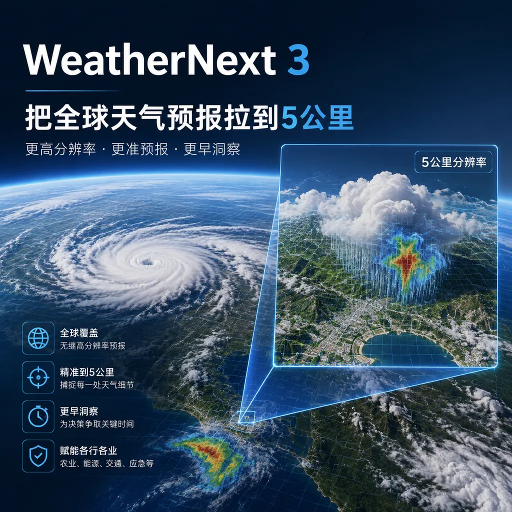
<think>**Translating announcement about WeatherNext 3**</think> Google DeepMind has released WeatherNext 3, which provides global weather forecasts at resolutions as fine as 5 kilometers, updated hourly, and adds specialized forecasting capabilities for wind power and photovoltaic applications.
<think>Clarifying translation scope and requirements</think>
WeatherNext 3 Brings Global Weather Forecasts Down to 5 Kilometers
Google DeepMind and Google Research today (September 3) released the next-generation global AI weather model, WeatherNext 3. Its core selling point is not simply extending weather forecasts several days further, but simultaneously advancing global forecast resolution and update frequency: the model can provide surface temperature, humidity, and other variables at resolutions as fine as 5 kilometers, while generating a new forecast every hour based on real-time global geostationary satellite data.
Google calls WeatherNext 3 the most advanced and accurate global AI weather forecasting model currently available. This statement still reflects the vendor’s own positioning, and publicly available materials do not yet provide sufficiently comprehensive, reproducible third-party evaluation results. From a product-design perspective, however, WeatherNext 3 is indeed closer than its predecessor to meteorological infrastructure that can be directly used in business operations, rather than merely a research model demonstrating AI forecasting capabilities.
Key Change: From “Global Trends” to “Local Weather”
The value of a weather forecasting model often depends on more than whether it can predict that “it will rain tomorrow.” It also needs to answer more specific questions: Which areas will receive the rain? When will it begin? Will wind affect airports, ports, and wind farms? How will valleys, coastlines, and urban heat islands alter the final outcome?
Traditional global numerical weather prediction models generally rely on complex physical equations and supercomputers. They discretize the state of the atmosphere into a grid and then continuously perform numerical integration. The finer the grid and the more frequent the updates, the higher the computational cost. As a result, global models are generally better at capturing large-scale weather systems, such as typhoon tracks, frontal movements, and upper-level wind fields. When it comes to neighborhoods, valleys, or localized convection, more costly regional models are typically needed for further downscaling.
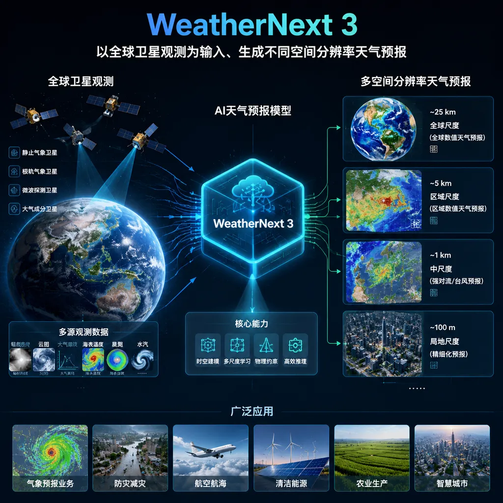
WeatherNext 3 attempts to eliminate this intermediate step by using AI directly. According to Google, the model can generate hourly forecasts at multiple spatial resolutions while maintaining physical consistency between global wind patterns and local terrain. Specifically:
- Key surface variables such as temperature and humidity are available at resolutions as fine as 5 kilometers;
- Other surface variables have a resolution of 10 kilometers;
- Atmospheric variables such as wind speed have a resolution of 25 kilometers.
These figures need to be understood separately. “As fine as 5 kilometers” does not mean that all weather variables are output at 5-kilometer resolution, nor does it mean that forecasts for every 5-kilometer grid cell have the same level of accuracy. Temperature and humidity can be represented on finer grids, while atmospheric variables such as wind speed remain at the 25-kilometer scale. For developers and business users, integration decisions should not be based solely on the most eye-catching resolution figure. They should also confirm the specific variables, forecast horizons, update intervals, and validation results for the target region.
Hourly Recalculation Focuses on Rapidly Changing Weather
Another change in WeatherNext 3 is its update frequency. The model ingests a composite of real-time global geostationary satellite data, continuously receives the latest observations of atmospheric conditions, and generates a new forecast every hour based on them.
This is particularly important for short-duration extreme weather. Storms, fronts, and heavy precipitation systems can develop rapidly within a few hours. In some scenarios, a forecast updated every six hours may already have missed a critical decision window. Hourly updates mean that airports can adjust flight schedules and de-icing plans more quickly, ports can arrange operations in a timely manner, and city authorities can assess the risks of flooding, high winds, or extreme heat earlier.
However, “hourly updates” also come with an easily overlooked caveat: what is updated is the model output, not a guarantee that the future will become more predictable. Satellite data can provide more timely observations of cloud systems and atmospheric conditions, but it cannot eliminate all forecast uncertainty. For highly nonlinear phenomena such as localized severe convection, thunderstorms, and short-duration torrential rain, the model may still need to be combined with radar, ground-station, and regional meteorological-agency data to produce sufficiently reliable warnings.
In other words, WeatherNext 3 is better understood as shortening the feedback cycle from “observation to forecast” than as turning weather prediction into a deterministic answer. For real production systems, probabilistic forecasts, confidence intervals, and multi-scenario outputs may be more important than a single result that merely appears more precise.
Sparse Weather-Station Data Make Global High-Resolution Forecasting More Practical
WeatherNext 3 also places particular emphasis on using sparse weather-station observations. The model can be trained under conditions with limited ground observations and generate global forecasts on a 5-kilometer grid while incorporating regional details such as terrain.
The significance of this is not merely a technical metric. Global weather-observation resources are unevenly distributed. North America, Europe, and parts of East Asia have relatively dense networks of ground stations and radar, as well as extensive high-performance computing resources. Meanwhile, parts of Latin America, Africa, and the Asia-Pacific region have long lacked high-resolution, low-latency weather forecasting capabilities. Traditional regional models require expensive supercomputing resources, and even regions with weather data may find it difficult to run sufficiently detailed models continuously.
The advantage of AI models is that once training is complete, inference can substantially reduce computing costs and time. Unlike traditional numerical models, they do not necessarily need to solve a complex set of physical equations from scratch every time. Instead, they learn patterns of atmospheric evolution from historical weather states and real-time observations. This makes it possible to rapidly generate high-resolution forecasts globally and gives local logistics, agriculture, insurance, energy, and public-safety operations the opportunity to use more granular data.
Of course, sparse observation stations do not mean that ground observations are no longer necessary. Ground stations remain essential for calibrating models and validating results, especially for variables such as temperature, precipitation, and near-surface wind speed. Whether the model can maintain stable performance in regions with sparse observations still requires long-term, region-specific validation.
Designed Specifically for Wind and Solar Power, Weather Models Are Beginning to Serve Energy Dispatch Directly
WeatherNext 3 does not stop at general weather variables. It also adds specialized forecasting capabilities for renewable-energy production.
For wind power, the model can forecast wind speeds at approximately 100 meters above ground, a height that roughly corresponds to the hub height of large wind turbines. Compared with near-surface wind speed, wind speed at 100 meters has a more direct impact on whether a turbine can reach its rated output. If wind forecasts are made only near the ground, additional vertical extrapolation and terrain correction are often required. WeatherNext 3 attempts to provide results that more closely match the operating conditions of wind-power assets.
For solar photovoltaics, the model provides high-resolution cloud-cover and solar-radiation data to help photovoltaic plants estimate the amount of sunlight reaching the ground. Solar output is highly sensitive to cloud changes: a rapidly moving cloud can cause local generation to drop significantly within a short period. Finer and more frequent cloud-cover forecasts can help grid operators schedule backup power in advance and allow energy-storage systems to determine when to charge or discharge.
This expands the customer base for weather models from “people who check the weather” to “people who make operational decisions based on the weather.” In the past, weather data was often just one input field in a business system. Now, model outputs can directly affect electricity trading, energy-storage control, wind and solar power forecasting, and equipment maintenance.
However, there is still a layer of business modeling between meteorological forecasting and power-generation forecasting. Turbine models, blade condition, site terrain, photovoltaic-panel angles, dust accumulation, and grid curtailment all affect final output. Therefore, WeatherNext 3 is better understood as providing high-quality meteorological inputs, not an API that automatically guarantees accurate generation estimates. Developers intending to use it in production will still need to combine it with historical asset data and locally calibrated models.
From WeatherNext 2 to WeatherNext 3: Google Is Filling in the Productization Pipeline
The previous WeatherNext 2 was primarily aimed at global medium-range ensemble forecasting. The typical configuration of its public dataset was a spatial resolution of 0.25 degrees, initialization every six hours, and a maximum forecast horizon of 15 days. It was better suited to climate analysis, scientific research, and medium-range trend assessment.
WeatherNext 3 takes a clearly different direction. It places greater emphasis on real-time satellite inputs, shorter update intervals, finer local grids, and embedding forecasting capabilities into Google’s existing products. Google announced that, starting today, WeatherNext 3 will provide weather capabilities for Google Search, the Gemini app, Google Maps, the Google Maps Platform Weather API, and Google Earth Engine.
This means Google is not simply releasing a model and waiting for developers to discover their own use cases. Instead, it is placing the model inside Search, Maps, and cloud-based geospatial analysis tools. For ordinary users, the changes may appear as more timely weather cards and map layers. For developers, however, the truly valuable question is whether these weather capabilities can be accessed through stable interfaces, clear licensing terms, and verifiable metrics.
So far, Google’s public introduction has focused primarily on model capabilities and product integration. Complete details regarding WeatherNext 3’s API specifications, usage limits, commercial pricing, historical-data retention policies, and validation reports for different regions have not yet been fully disclosed. Before using it for traffic dispatch, insurance pricing, or energy trading, developers should not make architectural decisions based solely on promotional phrases such as “the world’s most advanced.”
Competition Among AI Weather Models Is Not Just About Which One Has Higher Resolution
Following the release of WeatherNext 3, it would be easy to compare it directly with AI weather models such as GraphCast, Pangu-Weather, and FourCastNet. But such comparisons cannot be based solely on error metrics or maximum resolution reported in research papers.
First, the models have different objectives. Some excel at medium-range global forecasting, while others are optimized for hurricanes, precipitation, or specific regions. WeatherNext 3 places greater emphasis on real-time observational inputs, hourly updates, and deployment in Google products. Second, the forecast variables differ. Temperature, precipitation, wind speed, cloud cover, and solar radiation do not pose the same level of difficulty, and their performance cannot be summarized by a single overall score. Third, production usability also depends on latency, reliability, historical replay, data licensing, and robustness during severe weather.
More importantly, AI weather models have not made traditional numerical forecasting irrelevant. The more realistic direction today is to combine the two: traditional models provide physical constraints and long-term stability, while AI models accelerate inference, refine grids, fuse observations, and generate ensemble results. The emphasis WeatherNext 3 places on “physical consistency” also shows that Google does not intend to present the model as a black box completely detached from physical laws.
What It Means for Developers
If your product depends on weather data, WeatherNext 3 is worth watching. However, it is not advisable to immediately replace an existing weather-data provider simply because of the 5-kilometer figure. A more reasonable evaluation process would include:
- First, identify the variables your business actually needs. Temperature and humidity may be available on a 5-kilometer grid, but the actual resolution and error characteristics of wind speed, precipitation, and cloud cover need to be confirmed separately.
- Conduct regional backtesting. Global average metrics cannot represent actual performance in a particular city, along a coastline, in mountainous terrain, or in an agricultural region.
- Compare update latency. For disaster warnings and energy dispatch, the time required for data to arrive may sometimes matter more than gaining a few additional kilometers of spatial resolution.
- Retain probabilistic outputs and backup sources. Production systems should be able to handle model uncertainty and switch to other data sources when satellite data is delayed, the model behaves abnormally, or extreme weather occurs.
- Check usage boundaries. Weather forecasts can support decision-making, but they cannot replace official warnings and safety instructions issued by local meteorological authorities.
OpenAI Hub currently aggregates OpenAI-format APIs for general-purpose models such as GPT, Claude, Gemini, and DeepSeek. WeatherNext 3 is a specialized weather forecasting model, not a conversational or general-purpose reasoning model, so it cannot simply be used like “integrating a large model.” Teams that genuinely need it should pay closer attention to when the Google Maps Platform Weather API, Earth Engine datasets, or related enterprise services will offer complete developer interfaces.
Overall, the most noteworthy aspect of WeatherNext 3 is not that “AI has won another round in weather forecasting,” but that Google is moving global weather models from research demonstrations toward real-time products and industry infrastructure. Its practical value comes from the combination of 5-kilometer resolution, hourly updates, real-time satellite inputs, and specialized variables for wind and solar power generation.
But this remains a capability that requires long-term validation. The goal of weather prediction is not to generate a prettier map, but to give airports, cities, power grids, farms, and ordinary users judgments that are early enough, accurate enough, and honest enough when it matters most. Whether WeatherNext 3 can achieve that will ultimately depend on public evaluations, regional performance, and failure rates in real-world operations—not the maximum resolution highlighted at a product launch.