
<think>**Translating text without formatting** </think> NASA has open-sourced its lunar research model.
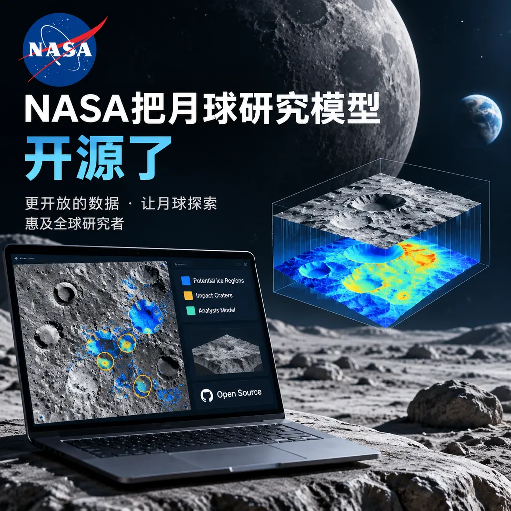
NASA and IBM have open-sourced a foundation model for lunar research that can identify potential ice-bearing regions and impact craters. It outperformed SwinV2-B in two tests, but still cannot replace scientific validation using spectroscopy, radar, and other methods.
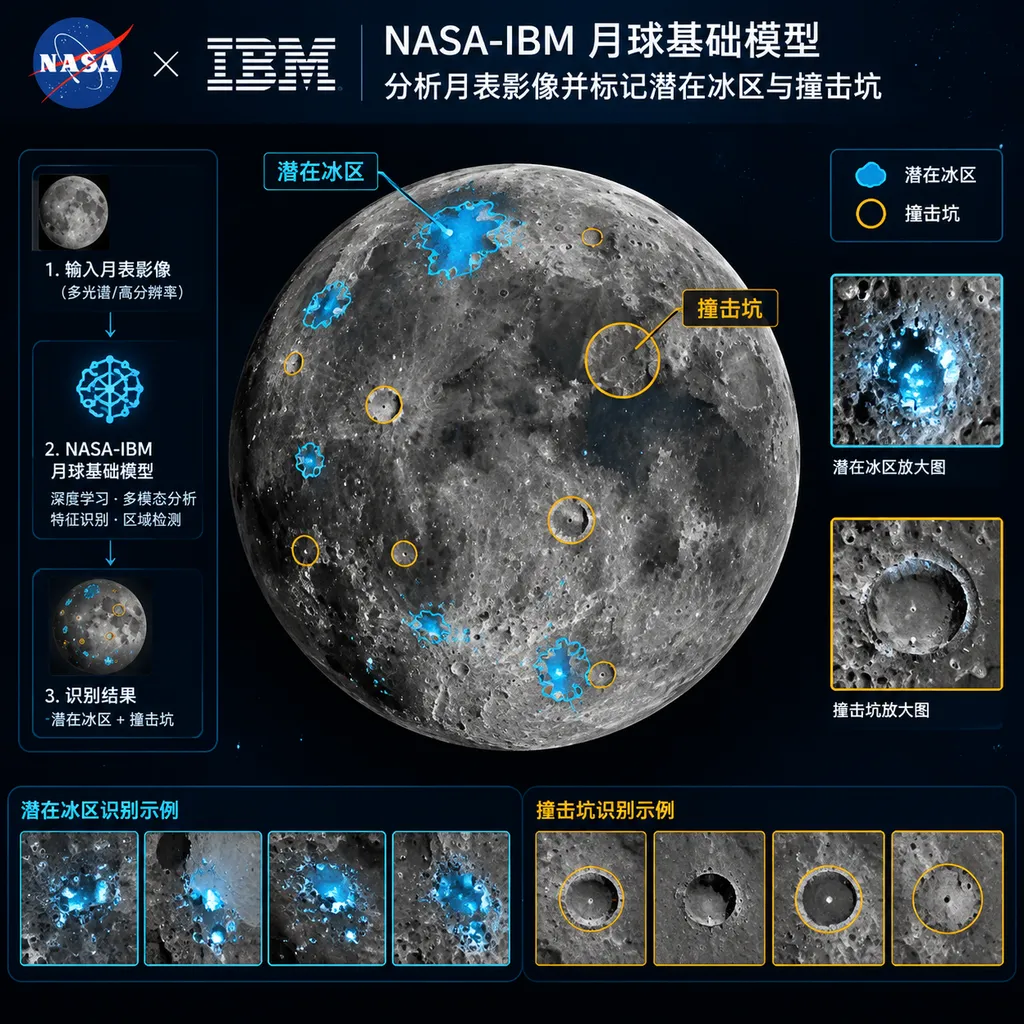
NASA and IBM jointly released an open-source foundation model for lunar research this week and made it available on Hugging Face. It is not a conversational language model, but a vision foundation model for processing remote-sensing imagery of the lunar surface. Its core capabilities demonstrated so far include locating areas that may contain water ice and detecting and classifying lunar impact craters.
What truly makes this model noteworthy is not that it is yet another research project labeled a “foundation model,” but that it outperformed the general-purpose vision model SwinV2-B on two relatively demanding tasks: it reduced errors in identifying potential ice-bearing regions by 23%, and achieved 19% better performance on the crater task while using only half as much training data.
However, these two figures should be interpreted cautiously. NASA and IBM have not yet fully disclosed the model’s parameter count, training dataset size, input modalities, evaluation metric definitions, or absolute accuracy in the publicly available information. Therefore, “23% lower error” does not mean a 23-percentage-point increase in accuracy, and “19% better performance” cannot be directly interpreted as greater reliability across all lunar-surface scenarios.
It Is Not a Lunar Version of ChatGPT, but a Remote-Sensing Vision Backbone
The term “foundation model” can easily evoke text generation, but the NASA-IBM lunar model is closer to a vision backbone pretrained on lunar remote-sensing data. Its purpose is not to answer open-ended questions such as “Is there water on the Moon?” but to transform orbiter imagery into features, regions, and objects that researchers can analyze further.
Traditional computer vision projects typically train a separate model for each task: one model detects craters, another segments shadowed regions, and yet another analyzes landforms. A foundation model instead first learns the general spatial structure of the lunar surface from large volumes of unlabeled or weakly labeled imagery, and is then adapted to specific tasks through fine-tuning or task-specific heads.
For developers, it can be understood as a “pretrained backbone for lunar remote sensing.” Research teams do not have to start from random weights every time, nor do they need to prepare equally large labeled datasets for every type of landform. With internet images, this difference may merely affect training costs. In deep-space remote sensing, however, it can directly determine whether certain few-shot tasks are feasible at all.
Lunar data is not unlimited. High-quality imagery is constrained by orbit, resolution, illumination angle, and sensor conditions, while expert-verified labels for craters, geological units, and potential water ice are even scarcer. The fact that the NASA-IBM model still outperformed SwinV2-B while using only half as much training data is therefore more valuable than a simple leaderboard advantage: it provides at least preliminary evidence that domain-specific pretraining can reduce dependence on manual annotation.
Two Tests: Finding Ice-Bearing Regions and Impact Craters
NASA and IBM first tested the model’s ability to locate areas of the lunar surface that may contain ice. The research team compared the model’s predictions with a lunar map generated through an established scientific workflow. That map was not derived from a single photograph, but combined terrain, temperature, and other environmental information to mark regions more likely to preserve water ice.
Compared with SwinV2-B, a model introduced by Microsoft and frequently used as an image-analysis benchmark, the NASA-IBM model reduced identification errors by 23% in this test. This suggests that a general-purpose vision model’s ability to recognize objects on Earth does not mean it inherently understands lunar landforms. Pretraining data and domain priors are often more important than simply scaling up the network.
The second test involved crater detection and classification. Using only half as much training data as the baseline model, the new model still outperformed SwinV2-B by 19%. Such a task may look like ordinary object detection, but the actual challenge goes far beyond “finding a circle.”
There are already more than one million impact craters over one kilometer in diameter on the lunar surface, and even more smaller ones. Craters from different eras and at different stages of degradation overlap with one another, while their rims may have been damaged by later impacts, landslides, and regolith modification. Old craters containing newer ones and new craters overlapping older ones are the norm, not edge cases. Detectors that rely primarily on circular outlines or shadow boundaries can easily double-count craters, miss incomplete ones, or misclassify ordinary terrain as a crater.
On August 5, an impact event associated with a SpaceX Falcon 9 gave the team an opportunity to validate the model under conditions resembling real-world incremental detection. IBM supplied the model with relevant imagery captured before and after the impact, and the model identified the newly formed crater in a single pass. Even though the new crater overlapped extensively with an existing one, it was not lost amid the older terrain.
The significance of this case goes beyond a visually impressive detection box. Static test sets are susceptible to issues such as spatial proximity, similar imaging conditions, and even data leakage. A newly formed impact could not have appeared in historical training data, making it closer to a genuine out-of-distribution sample. One successful case is certainly not enough to prove that the model has robust change-detection capabilities, but it does at least suggest that the model learned more than a crater template.
Lunar Imagery Is Even Less Forgiving Than Earth Remote Sensing
The central problem NASA and IBM encountered during training was illumination.
Earth has an atmosphere. After sunlight is scattered by the atmosphere, shadowed areas still receive some ambient light, and their edges generally show gradual transitions in brightness. Even in images taken by ordinary cameras, shadows often retain texture, albeit at a lower signal-to-noise ratio.
The Moon has virtually no atmosphere. The boundary between intense light and shadow can be razor-sharp, and some shadowed pixels carry almost no useful information about the surface. At a low solar elevation angle, the same crater may appear half brightly illuminated and half completely black. At a different imaging time and under a different lighting direction, the light-dark relationship may be reversed. To a model, this is less like changing the exposure of the same object and more like deleting half of it altogether.
This creates three typical problems:
- Illumination shortcuts: The model may treat a fixed arrangement of light and dark as a crater instead of truly learning terrain structure.
- Cross-temporal mismatch: The same area may look dramatically different under different solar incidence angles, causing change-detection systems to mistake lighting changes for terrain changes.
- Missing information in shadows: Common image-enhancement methods can adjust brightness, but they cannot recover surface details that were never recorded by the sensor.
In natural-image pretraining, randomly masking parts of an image and asking the model to reconstruct the content is a common self-supervised technique. However, permanently or extremely shadowed regions in lunar imagery are not missing uniformly at random. They are closely related to terrain slope, solar angle, and latitude. If these missing areas are still treated as ordinary masked regions, the model may generate “answers” that follow statistical patterns but violate actual geological conditions.
Models of this kind therefore cannot be evaluated solely by pixel-level reconstruction quality. More appropriate assessments should also cover generalization across regions, robustness across illumination conditions, transfer between sensors with different resolutions, and consistency with elevation, temperature, radar, and spectral data.
Finding “Places That May Contain Ice” Is Not the Same as Discovering Water Ice
This is the most important distinction to draw regarding this release.
The model currently identifies regions more likely to preserve ice; it does not directly confirm the presence or quantity of water ice. Some craters in the lunar polar regions receive no sunlight for extended periods, with temperatures falling below 100 K and creating “cold traps” suitable for the long-term preservation of volatiles. Terrain, temperature, and the distribution of permanently shadowed regions can all be used to narrow the search area.
But visual correlation is not evidence of material composition. If a region combines low temperatures, shadows, and particular landforms, that only means it warrants further observation. Determining whether water ice is actually present, what form it takes, and whether its concentration makes extraction worthwhile requires spectral, radar, neutron-detection, and thermal-infrared data—and ultimately may require drilling and in-situ analysis by a lander.
Similar controversies have arisen in previous studies of the lunar polar regions. Radar anomalies were once interpreted as evidence of large quantities of water ice, but later research found that multiple scattering from rough surfaces and rocks could produce similar signals. If an AI model learns only the statistical correlations in historical maps, it may likewise mistake an “environment that resembles one containing water ice” for water ice itself.
The model is therefore more like a highly efficient candidate-region screening tool than an automated scientific arbiter. It can reduce a vast volume of imagery that experts would otherwise need to inspect individually into a prioritized list, but it cannot make the final determination for the research team.
Why a Domain Model Can Beat SwinV2-B
SwinV2-B is a powerful general-purpose vision baseline. It processes high-resolution images using hierarchical features and shifted-window attention, and has mature applications in classification, object detection, and semantic segmentation. NASA and IBM’s decision to use it as the baseline is more convincing than comparing their model with an early convolutional network.
However, this comparison does not necessarily mean the new lunar model has a more advanced architecture. A more likely explanation is that it was exposed to more data matching the lunar-surface distribution and was adapted to the scale, texture, and illumination challenges found in lunar imagery.
A general-purpose model recognizes a “circle”; a domain model must recognize a crater that has been eroded, obscured, and overlapped, with only part of its rim remaining. The former learns visual commonalities, while the latter learns geological semantics. The same logic applies to specialized fields such as medical imaging, satellite remote sensing, and materials microscopy: model size matters, but data distribution usually matters more.
This release can also be viewed alongside the specialized multimodal lunar-science model launched in 2024 by the Institute of Geochemistry at the Chinese Academy of Sciences and Alibaba Cloud. That model was built on Qwen vision, multimodal, and language models, combined RAG with 17 categories of lunar-science data, and emphasized scientific Q&A, modality recognition, and crater analysis. The NASA-IBM model, based on what has been publicly demonstrated so far, focuses more on foundational remote-sensing vision capabilities and transfer to downstream tasks.
The two are not simply competing products of the same type. One is more like a multimodal assistant for scientific workflows, while the other is more like a vision backbone that researchers can continue fine-tuning. The truly valuable direction may be to combine the two approaches: a vision model could extract robust features from raw imagery, while a multimodal system could organize imagery, elevation, spectral data, temperature, and knowledge from the scientific literature into a unified analysis workflow.
Open Source Is a Starting Point, Not a Guarantee of Scientific Usability
NASA and IBM have made the model available on Hugging Face, which is good news for planetary-science teams. Researchers can reproduce its results across different lunar regions, resolutions, and tasks, and can examine whether the model is overly dependent on a particular sensor or specific illumination conditions.
However, current public reports still omit several pieces of information that developers genuinely care about:
- The specific open-source license covering the model weights, including whether commercial use and redistribution are permitted;
- The sources, geographic coverage, resolution, and time range of the pretraining imagery;
- Whether the training, validation, and test sets were strictly separated by geographic region;
- The input modalities used for the potential ice-region task, including whether auxiliary data such as elevation and temperature were included;
- Which metrics the 23% and 19% figures respectively refer to, and whether they were validated through multiple runs and statistical significance testing;
- The GPU memory required for inference, the image-tiling strategy, and the throughput for processing data at a global lunar scale.
Randomly splitting image patches can especially inflate results in remote-sensing tasks. Adjacent patches may come from the same orbit, the same landform, or even the same original image. During testing, the model may not be seeing a genuinely new region, but merely a patch next to an area used during training. Only by separating test sets according to lunar geography and imaging time can evaluation more closely reflect real-world deployment.
Open model weights make it possible for external teams to scrutinize these issues. This is also what makes the release more valuable than a closed scientific system that publishes only paper metrics.
It Will Enter Research Pipelines Before It Directly Controls Lunar Missions
This spring, Artemis II completed the first crewed flight around the Moon since 1972. NASA will next need to process larger volumes of lunar remote-sensing data for subsequent missions, including candidate landing-site assessment, terrain-risk analysis, resource exploration, and monitoring of surface changes.
In the near term, the most realistic use of the NASA-IBM model is not to let AI autonomously decide where to land, but to integrate it into the front end of mission planning:
- Screen polar landforms in bulk for possible volatiles;
- Automatically update crater catalogs and reduce repetitive manual annotation;
- Compare imagery from different times to identify new impacts and surface changes;
- Provide candidate features for analyzing landing-site slopes, obstacles, and geological ages;
- Serve as a transfer-learning starting point for remote-sensing tasks on other planetary bodies.
Crater statistics are also directly related to geological dating of the lunar surface. The Moon lacks Earth-like plate tectonics and intense weathering, allowing many ancient impact records to survive. Identifying their numbers, diameters, and overlapping relationships can help researchers determine the relative ages of geological units. However, later impacts can obscure earlier craters. If automated models can better identify overlapping and degraded structures, they may revise results previously obtained through visual counting.
Assessment: A Useful Research Backbone, but Not “AI Finding Water on the Moon”
The most substantive aspects of this NASA-IBM release are its data efficiency and the real-world case involving a new impact—not the name “lunar foundation model.”
Outperforming a mature vision baseline with only half as much labeled data shows that domain-specific pretraining can indeed be effective for few-shot scientific tasks. Successfully identifying a new crater overlapping an older one also demonstrates some ability to distinguish complex landforms. For research teams that need to process vast amounts of orbital imagery, that is already useful enough.
However, identifying potential ice-bearing regions remains only a form of candidate generation. Without cross-validation using spectral, radar, temperature, and in-situ measurements, any claim that “AI has discovered water ice on the Moon” would be an overstatement. The most appropriate role for a scientific foundation model is to expand researchers’ search scope, reduce annotation costs, and identify anomalies—not to package probabilistic predictions as scientific facts.
If a complete model card, training-data documentation, geographically isolated test results, and a multimodal input scheme are released later, this model could become a shared foundation for lunar remote-sensing research. Otherwise, for now it is better understood as a promising domain-model release that still awaits independent reproduction.
References
- ITHome: NASA and IBM Jointly Release an Open-Source Foundation Model for Lunar Research — Introduces the model release, results from the potential ice-region and crater tests, and the training challenges created by extreme illumination on the lunar surface.