
Gaode releases 3D city world model: Rebuild a city in 10 minutes from a single satellite image
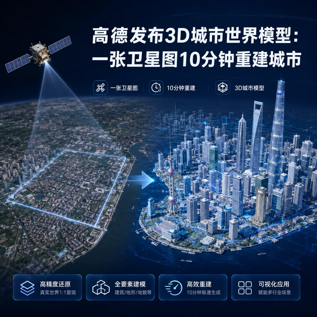
Gaode releases the world’s first 3D native city world model, ABot-Earth 0.5. A single satellite image can generate kilometer-scale 3D urban scenes on a consumer-grade GPU in just 10 minutes, reducing costs to 1% of traditional methods and increasing efficiency by a thousand times. It has already covered over 190 countries and regions.
Gaode Releases 3D City World Model: Rebuild a City in 10 Minutes from a Single Satellite Image
Today (June 8), Gaode, a subsidiary of Alibaba, officially released ABot-Earth 0.5 — the world’s first engineering-ready, 3D-native city world model completely trained on 3D data. The core capability of this model is: give it a satellite image or a text description, and it can generate kilometer-scale 3D urban scenes within 10 minutes on a consumer-grade GPU.
This is not a demo — it’s a truly usable production tool. The output format is 3DGS (3D Gaussian Splatting), which can be directly imported into mainstream engines like Unity and Unreal Engine for secondary development. According to Gaode’s estimates, the cost is only 1% of traditional methods, with efficiency boosted by about 1,000 times.
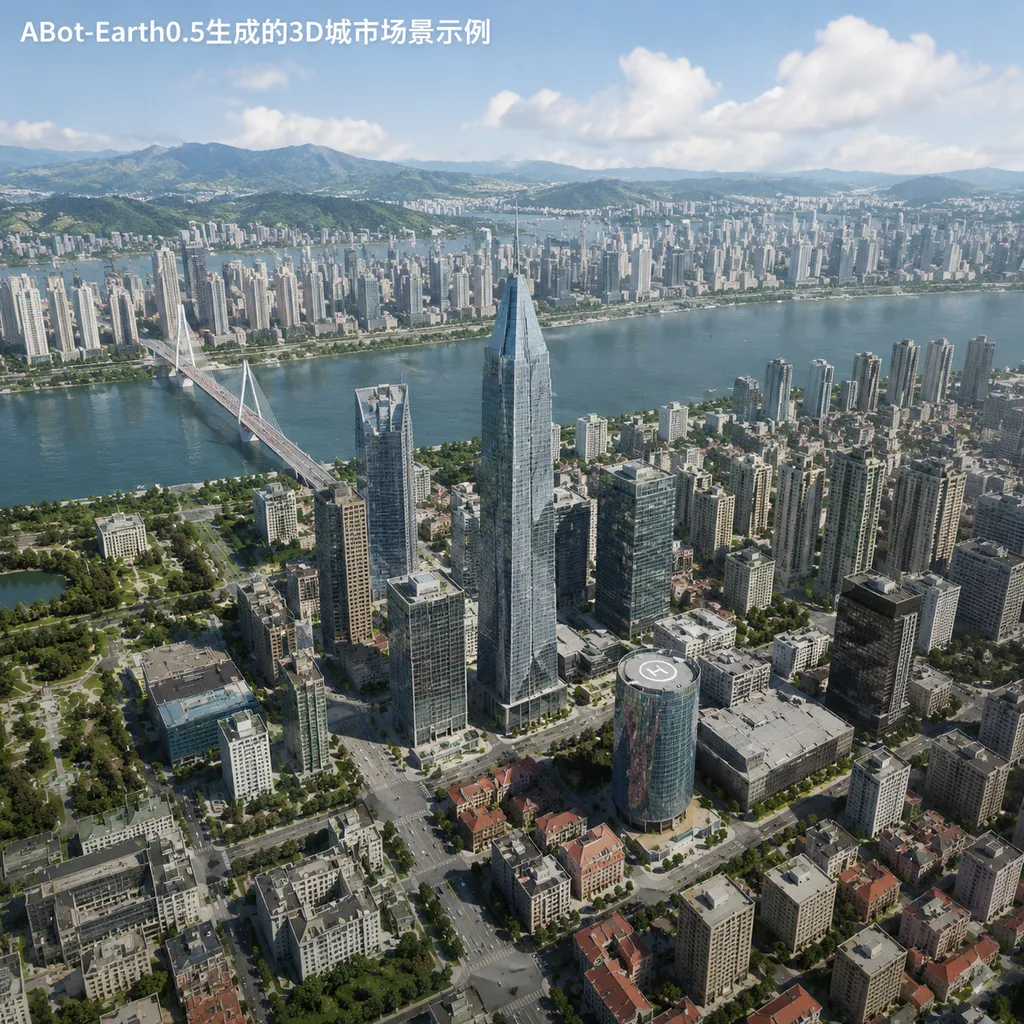
Traditional 3D Modeling is a Handcraft Workshop, ABot-Earth is an Automated Factory
You may have heard of the traditional 3D map production process: aerial photography, point cloud processing, machine stitching, manual touch-ups. Every step requires specialized equipment and a lot of manpower, and completing 1 square kilometer usually takes hours to days. The problem with this process is not just that it’s slow and expensive — the real killer is that it can’t be scaled. Creating high-precision 3D maps for over 190 countries worldwide? Using traditional methods, that’s basically an impossible task.
ABot-Earth 0.5 takes a completely different approach. It is a world model entirely trained on 3D data, with input being 2D satellite imagery or text descriptions, and output being editable 3D scenes. This process doesn’t require LiDAR, oblique photography, or manual touch-ups — AI directly understands buildings, roads, and vegetation in the satellite image, then generates the corresponding 3D structures.
The key is speed and cost. 10 minutes, one consumer-grade GPU, kilometer-scale scenes — this combination of metrics means 3D city modeling has shifted from a "heavy-asset specialized engineering" to a "lightweight general-purpose tool." Gaode has already used this system to produce the world’s most extensive coverage 3D map, spanning over 190 countries and regions.
3DGS Format: Not Just for Viewing, but Directly Usable
ABot-Earth 0.5 outputs not traditional point clouds or mesh models, but the 3DGS format. This format has recently become popular in graphics research, with core advantages including fast rendering, high quality, and small file size. More importantly, it can be directly imported into mainstream game engines like Unity and Unreal Engine, enabling developers to carry out interactive development, path planning, and physics simulation within the generated 3D urban scenes.
This feature is especially critical for embodied AI and robot training. Traditional robot simulation training requires manually building virtual environments, which is costly, time-consuming, and usually covers only limited scene types. With ABot-Earth 0.5, you can quickly generate corresponding 3D training scenarios from satellite images of real cities, allowing robots to run their algorithms in virtual environments before transitioning to the real world.
Gaode's previously released city-scale simulation training grounds are powered by ABot-Earth 0.5 at their core. These training grounds supported Gaode TuTu — the world’s first fully autonomous robot in open environments — for simulation training in urban environments. In the embodied AI track, the diversity and scale of training data directly determine the model’s generalization ability, and ABot-Earth 0.5 reduces training scenario construction time from days to minutes, filling the gap in open-environment training data.
Application Scenarios: From Low-Altitude Economy to Emergency Rescue
Gaode listed several typical application scenarios, each addressing real pain points:
Low-Altitude Economy
Core applications in the low-altitude economy, such as drone delivery and eVTOL (electric vertical take-off and landing aircraft), require high-precision 3D terrain data for route planning, obstacle avoidance, and landing. Traditional surveying has blind spots in complex terrains (mountains, canyons) and special areas (border zones, islands), whereas ABot-Earth 0.5 can quickly generate 3D terrain for these areas from satellite imagery, providing maps where none previously existed.
This capability is highly significant for the commercialization of the low-altitude economy. To scale drone logistics, route planning and safety must be addressed first — and 3D maps are essential infrastructure. ABot-Earth 0.5 drastically reduces both the cost and timeframe of building this infrastructure.
Film and Games
In open-world games and film special effects production, 3D modeling of urban scenes has always been one of the most labor-intensive tasks. Modelers must manually create buildings, roads, vegetation, adjust details, and optimize performance. ABot-Earth 0.5 directly outputs editable 3DGS materials, enabling creators to focus on creativity rather than repetitive modeling work.
For indie game developers and small teams, this tool is even more impactful. In the past, creating realistic open-world urban game scenes could require tens of people working for months; now, one person can generate a base scene in 10 minutes, leaving the rest of the time for polishing gameplay and narrative.
Emergency Rescue
This scenario might have the greatest social value. After disasters like earthquakes, floods, or fires, rescue command centers need to quickly understand the 3D environment of the site: which roads are blocked, which buildings have collapsed, and which areas can be used as temporary assembly points. Traditionally, drones are dispatched for field surveys, images are transmitted back, and then analyzed manually — this entire process can take several hours.
ABot-Earth 0.5’s minute-level 3D mapping capability can quickly restore the disaster site’s 3D environment, providing scientific evidence for command and scheduling. In rescue scenarios, this time difference of a few hours could mean lives saved.
Several Technical Key Points
How is Accuracy Guaranteed?
The biggest challenge in generating 3D scenes from 2D satellite images is inferring building heights, shapes, and occlusion relationships. Gaode hasn’t disclosed detailed technical specifications, but from the phrase “completely trained on 3D data,” ABot-Earth 0.5 is likely trained on large-scale 3D urban datasets, learning the mapping from 2D to 3D.
The accuracy of this method certainly won’t match direct measurement by LiDAR, but for most application scenarios, it’s sufficient. Robot simulation training, game scene production, low-altitude route planning — these scenarios are less strict on precision than surveying, valuing coverage and generation speed more.
How Large a Scene Can a Consumer-Grade GPU Handle?
"10 minutes, consumer-grade GPU, kilometer-scale scene" — this set of metrics is interesting. Kilometer-scale scenes mean coverage of 1–2 square kilometers of urban area, containing hundreds of buildings, road networks, and vegetation. With traditional modeling methods, such a 3D scene might require tens of gigabytes of files and would need workstation-level hardware for rendering and editing.
Here, the advantages of the 3DGS format come into play: smaller file sizes and higher rendering efficiency compared to traditional mesh models. However, “consumer-grade GPU” is vague — is it an RTX 4060 or RTX 4090? Is the 10 minutes generation time or does it include optimization and export? Gaode hasn’t published these details, and actual testing is required for evaluation.
How Strong is Generalization Ability?
Gaode claims coverage of more than 190 countries and regions, meaning the model must handle scenes with diverse climates, architectural styles, and urban densities — European stone-built old towns, Middle Eastern desert cities, dense Southeast Asian shanty towns, and North American suburbs, all with vastly different visual characteristics. Can the model handle them all well?
From available information, ABot-Earth 0.5 is likely trained on global satellite imagery and 3D data, so its generalization ability should be solid. But for certain special scenarios (e.g., polar regions, tropical rainforests, deserts), generation quality may require further real-world testing.
Competitors and Differentiation
3D city modeling is not a niche track. Google Earth, Cesium, and Mapbox are all doing similar work; game engine companies like Epic (Unreal Engine) and Unity also have urban scene generation tools; and some startups are developing AI-driven 3D reconstruction tools.
Gaode’s differentiator is its “3D-native” positioning — completely trained on 3D data, with inputs and outputs optimized for 3D scenes. Google Earth’s 3D cities rely mainly on oblique photography and manual modeling — highly precise but costly; Cesium and Mapbox lean toward geospatial visualization with rendering quality and interactivity inferior to game engines; game engine procedural generation tools (like Unreal’s PCG) are flexible but require extensive manual parameter tweaking.
ABot-Earth 0.5’s positioning sits between precise surveying and procedural generation: much faster and cheaper than surveying, more realistic and geographically accurate than procedural generation. This positioning is a must-have for emerging scenarios like embodied AI, low-altitude economy, and content creation.
Another noteworthy point is openness. Gaode has already opened beta testing applications (abot-earth.amap.com), meaning it could become a platform-level service rather than just an internal tool. If pricing is reasonable and APIs are easy to use, it could become fundamental infrastructure for robotics, gaming, and film industries.
Commercialization and Long-Term Value
Gaode hasn’t announced ABot-Earth 0.5’s commercialization model, but judging from the application scenarios, several directions seem probable:
- SaaS Service: Charge by generated area or number of requests; targeting game developers, robotics companies, and low-altitude economy enterprises
- Data Licensing: License generated 3D scene data to other mapping service providers or platforms
- Customization Service: Provide high-precision customized 3D modeling for specific industries (e.g., emergency response, defense)
- Free + Premium: Basic functions free; charge for high precision, high-frequency use, and commercial licensing
In the long run, the value of ABot-Earth 0.5 lies not only in the tool itself, but also in the new paradigm it defines: using AI to map the 2D world into 3D space, turning 3D content generation from specialized engineering into a general capability. If this paradigm works, it will impact not only the mapping industry but the entire spatial computing ecosystem — AR/VR, embodied intelligence, autonomous driving, low-altitude economy — all of which need high-precision, large-scale, low-cost 3D world representations.
Gaode’s launch of ABot-Earth 0.5 at this point aligns with several converging trends: the boundaries of generative AI capabilities are rapidly expanding; embodied AI and robotics are moving from labs to applications; and policies and infrastructure for the low-altitude economy are accelerating. If ABot-Earth 0.5 can achieve commercialization in these scenarios, it could be not just a 3D modeling tool, but foundational infrastructure for the spatial intelligence era.
Of course, it’s too early to draw conclusions. The model has just been released, and actual performance, stability, and cost structure still require more empirical data. But at least from the technical approach and application positioning, Gaode has found a direction worth deep exploration.
ABot-Earth 0.5 is currently open for beta testing. Interested developers can visit the official site (abot-earth.amap.com) to apply and test firsthand whether this “10-minute city rebuild” is truly reliable.
References
- World’s First: Gaode Releases 3D-Native City World Model ABot-Earth 0.5 — Rebuild 3D City in 10 Minutes from a Single Image - IT Home — Detailed report from IT Home on the release of ABot-Earth 0.5